DIGITAL TERRAIN MODELLING
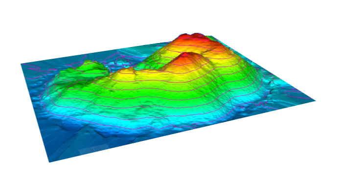
It may be needed to know the topography of a ground surface at high precision for planning construction projects, being able to make changes during construction, monitoring and keeping the works under control. The FARO LASER SCANNER FOCUS S 150 makes it possible to collect the most precise and detailed data. Compared to the conventional geodesical methods, its advantage is that the laser scanner captures everything what it sees of the surroundings, and the entire surroundings can later be modeled, if new needs arise. Unlike photogrammetry, it is possible to laser scan under any circumstances not taking into consideration the lighting and the weather conditions, in this way we can measure anywhere, any day of the year.
After cutting the unnecessary objects out from the pointcloud, like vegetation, the model could be created at an accuracy of a centimeter. Repeating the whole process at set intervals, the changing of ground level can be traced.